Flood Prediction and Preparedness: A Case Study of Calgary and Denver
Project Overview
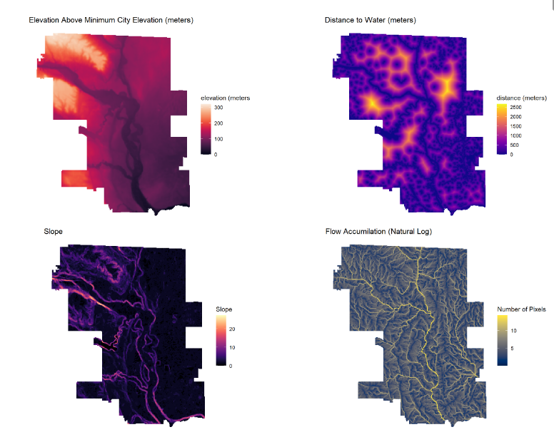
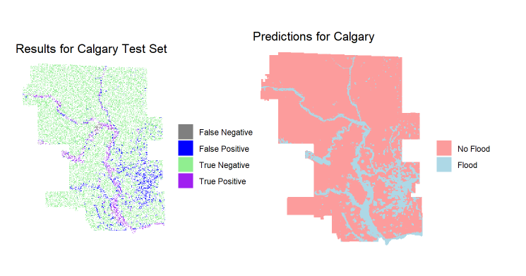
In June 2013, Calgary experienced extreme flooding, displacing 100,000 people and causing $1.7 billion in damages. This project aims to develop a predictive model using logistic regression to help Calgary and similar cities better prepare for such events. By analyzing predictors like elevation, land cover, slope, distance to water, and water flow accumulation, the model helps identify areas at risk of flooding beyond just riverine zones.
The model’s results aid in early action and planning, assisting decision-makers and the public in identifying areas needing evacuation, buyouts, or building code revisions. Using data from the 2013 Calgary flood, we also applied the model to predict flood risks in Denver, a city with similar geographic characteristics.
This project was completed as part of the Land Use and Environmental Modeling course (CPLN 6750 / MUSA 6750) at the University of Pennsylvania. It demonstrates the application of spatial data and empirical models to support decision-making in urban planning and disaster preparedness.
Click any image to read the full report on RPubs, detailing our methodologies and findings.